Established: August 1, 1916
Size: 323,431 acres
Annual Visitors: 2 million
Visitor Centers: Kilauea, daily 9 a.m. to 5 p.m.
Entrance Fees: $30 per vehicle; $15 per individual
Exploring Hawaii Volcanoes National Park, on the Big Island of Hawaii, is like stepping foot on another planet.
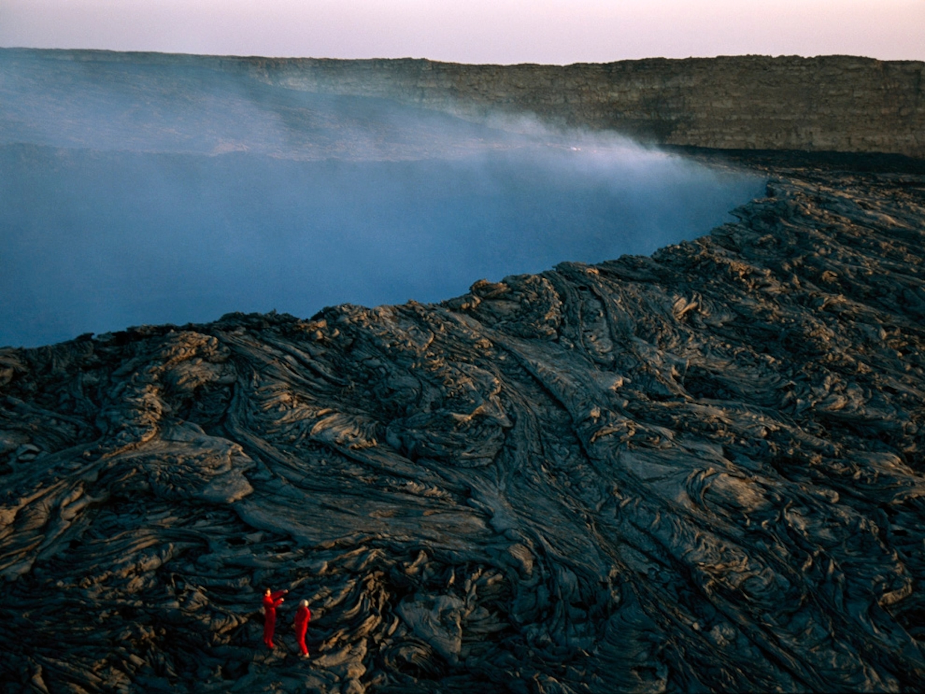
Recent lava flows stretch out for miles in a rocky wasteland that more closely resembles the Moon than Earth. Huge waves send sea spray dozens of feet into the air along the wild, craggy coastline. Endangered birds waddle across the path on an ascent up the world’s largest single mountain. If the timing is right, visitors can catch a natural fireworks show of lava pouring into the ocean or see plumes of molten rock arching above one of the planet’s rare lava lakes.
Two celebrated volcanoes—one of them very tall, the other very active—frame this large national park. From glowing lava flows and earth-shaking tremors to wind, rain, and waves, the geological and meteorological forces that shaped our planet are fully on display on the Big Island. While volcanism rules the day, pockets of rainforest and grassland shelter rare Hawaiian flora and fauna.
“Double, double toil and trouble; fire burn and caldron bubble.” Shakespeare could just as easily have been describing Hawaiian volcanoes rather than a witch’s brew in Macbeth. No other national park produces so much drama on a regular basis.
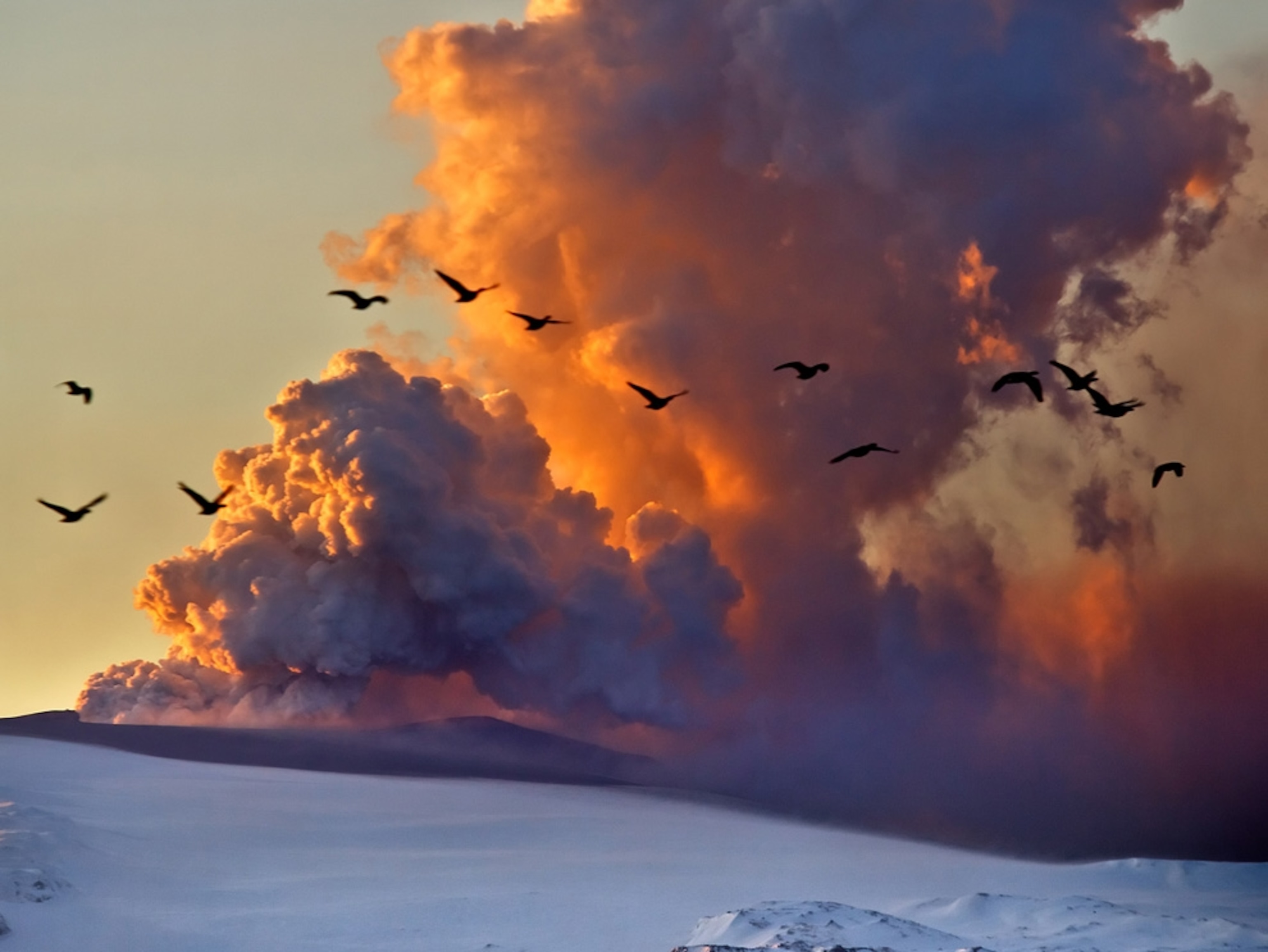
Kilauea is one of the world’s most active volcanoes. Its monthslong 2018 event destroyed hundreds of homes, sent massive plumes of ash rocketing into the air, and collapsed nearly 2,000 feet of the crater’s summit. Its most recent and currently ongoing eruption began in September 2021.

It abuts the southeastern slope of the older and much larger Mauna Loa, or “long mountain.” Active for some 700,000 years, Mauna Loa towers 13,677 feet above the sea. Measured from its base 18,000 feet below sea level, it exceeds Mount Everest in height. Mauna Loa’s gently sloping bulk—some 19,000 cubic miles in volume—makes it the planet’s most massive single mountain.
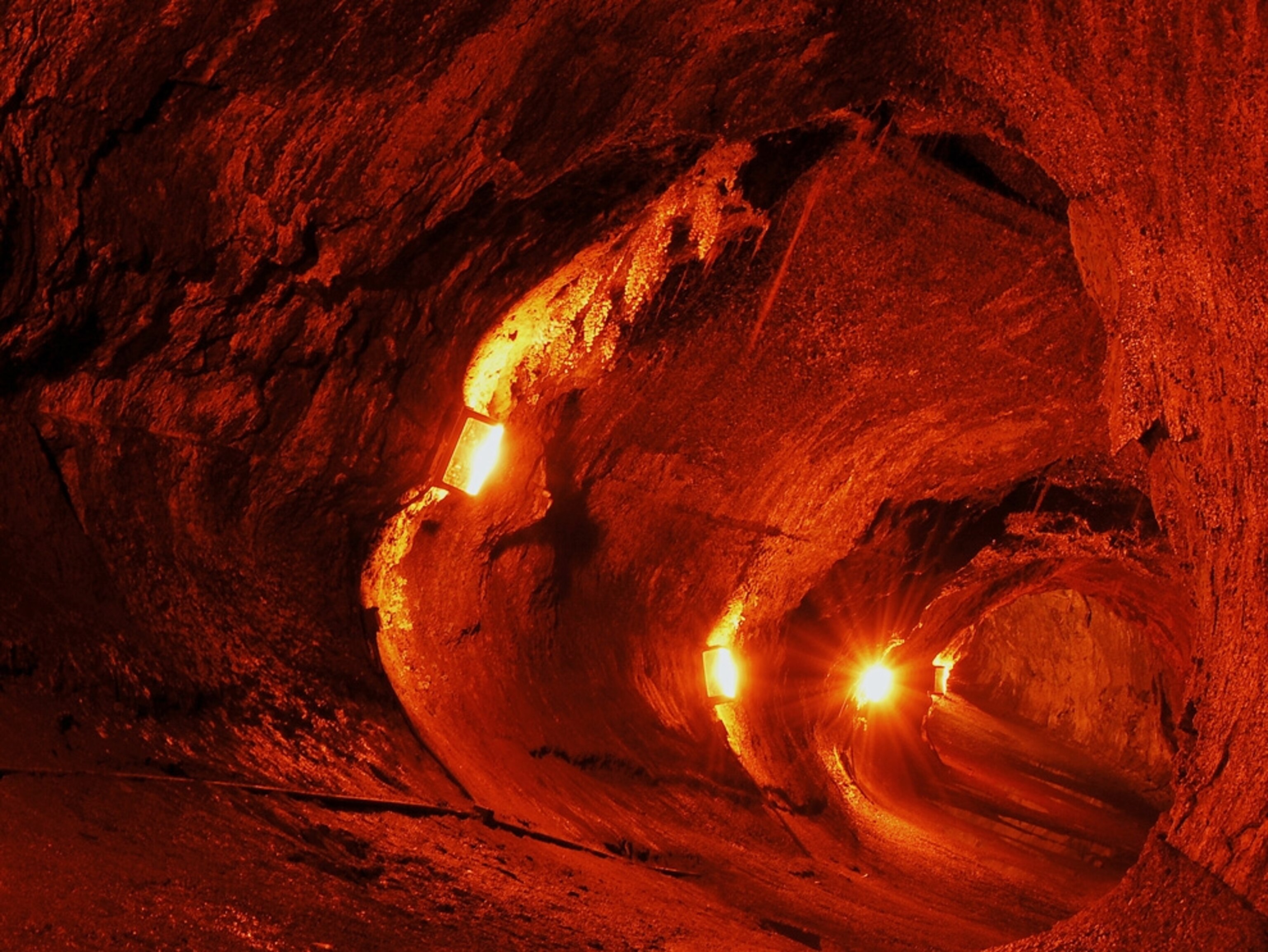
The national park stretches from sea level to Mauna Loa’s summit. Beyond the end of the road lies Mauna Loa's wilderness area, where backpackers encounter freezing nights and rough lava trails amid volcanic wonders: barren lava twisted into nightmarish shapes, cinder cones, and gaping pits. Kilauea, however, provides easy access to a greater variety of scenery and cultural sites.
On the slopes of Kilauea, whose name means “spreading, much spewing,” lush green rainforest borders stark, recent lava flows. This natural laboratory of ecological change displays all stages of forest regeneration—from early regrowth of lichens and ferns to dense forest. The rainforest on the windward side of Kilauea’s summit gives way to the stark, windswept Kau Desert on the hot, dry southwestern slope. At the shore, waves create lines of jagged cliffs; periodic eruptions send fresh lava flows to meet the sea amid colossal clouds of steam.
Geological dynamism forms the park’s primary natural theme, followed closely by evolutionary biology. Thousands of unique species have evolved on the isolated Hawaiian islands. Cultural sites abound as well, reminders of the Polynesian pioneers who steered their great double-hulled canoes to Hawaii beginning some 1,500 years ago.
The United Nations has named the park both an international biosphere reserve and a World Heritage site. Many of the park’s intriguing native plants and animals, however, are in peril, defenseless against alien species including weedy invasive plants and feral pigs. The native species are carefully protected by the park, which has fenced the park’s borders off from feral pigs and taken efforts to eradicate invasive weeds.
Can’t-miss experiences
Two outstanding auto routes provide easy access to the park’s main attractions. Crater Rim Drive hugs the edge of Kilauea Caldera and leads to viewpoints where visitors can gaze into the belly of the beast and inhale its pungent sulfur scent. Near the start of the route, the park Visitor Center offers exhibits and important safety information, as well as an excellent film, “Born of Fire, Born of the Sea.”
(Volcano tourism is booming, but is it too risky?)
Across the road, Volcano House (built in 1846) is one of the oldest lodges in the entire National Park System; the back terrace is a great place to get your first glimpse of the crater. Located in another historic structure, Volcano Art Center offers classes and workshops, a gallery dedicated to local artists, hula performances, and free guided hikes into the Niaulani rainforest.
When surface lava is flowing in the park, sightseeing boat tours offer the chance to watch molten lava hiss and steam as it met the ocean at Kamokuna. Explore Chain of Craters Road, which meanders 20 miles through tortuous volcanic landforms between Kilauea Caldera and Holei Sea Arch. Numerous places en route beg a stop, including lofty Kealakomo Overlook, the Martian-like landscape of Mau Loa o Mauna Ulu lava field, and the boardwalk trail that leads to the Pu‘u Loa Petroglyphs, where more than 23,000 images were rendered by native Hawaiians between A.D. 1200 and 1450.
Reaching the summit of Mauna Loa is a herculean effort. A narrow, paved road ascends to a lookout point at 6,662 feet. The rest of the route is on foot, a 16-mile trail that quickly morphs from native woodland into lava rock wilderness. Most people undertake the trek over four days, with overnights in national park mountain huts.
The park’s other iconic backcountry hike is the Kau Desert Trail, a rugged 18-mile trek that leads from the trailhead off of Highway 11 across undulating lava fields to Hilina Pali cliffs and overnight campsites along the Pacific coast like Halape with its sandy beaches and coconut grove.
Where to stay
Hotels: Inside the park, the historic Volcano House has long captivated guests; recently renovated, it perches on the rim of Kilauea caldera, offering stunning views and a unique perspective. The elegant Volcano Village Lodge sits just two miles outside of the park.
Camping: There are two drive-in campgrounds in Hawaii Volcanoes National Park, Namakanipaio and Kulanaokuaiki. The former offers rustic, but charming, camping cabins.
Off-season activities
Mauna Kea National Natural Landmark: At 13,803 feet, this volcano is the nation’s highest insular mountain, as well as the highest point in Hawaii. Onizuka Center for International Astronomy facilitates public stargazing on the peak.
Ala Kahakai National Historic Trail: This 175-mile coastal route around the Big Island features eight sites significant to native Hawaiian culture and history, including Pu’uhonua o Hōnaunau and Kaloko-Honokōhau national historical parks.
Pu‘u O Umi Natural Area Reserve: Perched on the Big Island’s north shore, this remote reserve harbors 13 native ecosystems including rare montane bog and ‘ohi’a forest.
Hawaii Tropical Botanical Garden: Just north of Hilo, this 17-acre preserve showcases more than 2,000 plant species including palms, bromeliads, and heliconias.
You May Also Like
Go Further
Animals
- How can we protect grizzlies from their biggest threat—trains?How can we protect grizzlies from their biggest threat—trains?
- This ‘saber-toothed’ salmon wasn’t quite what we thoughtThis ‘saber-toothed’ salmon wasn’t quite what we thought
- Why this rhino-zebra friendship makes perfect senseWhy this rhino-zebra friendship makes perfect sense
- When did bioluminescence evolve? It’s older than we thought.When did bioluminescence evolve? It’s older than we thought.
- Soy, skim … spider. Are any of these technically milk?Soy, skim … spider. Are any of these technically milk?
Environment
- Are the Great Lakes the key to solving America’s emissions conundrum?Are the Great Lakes the key to solving America’s emissions conundrum?
- The world’s historic sites face climate change. Can Petra lead the way?The world’s historic sites face climate change. Can Petra lead the way?
- This pristine piece of the Amazon shows nature’s resilienceThis pristine piece of the Amazon shows nature’s resilience
- Listen to 30 years of climate change transformed into haunting musicListen to 30 years of climate change transformed into haunting music
History & Culture
- Meet the original members of the tortured poets departmentMeet the original members of the tortured poets department
- Séances at the White House? Why these first ladies turned to the occultSéances at the White House? Why these first ladies turned to the occult
- Gambling is everywhere now. When is that a problem?Gambling is everywhere now. When is that a problem?
- Beauty is pain—at least it was in 17th-century SpainBeauty is pain—at least it was in 17th-century Spain
Science
- Here's how astronomers found one of the rarest phenomenons in spaceHere's how astronomers found one of the rarest phenomenons in space
- Not an extrovert or introvert? There’s a word for that.Not an extrovert or introvert? There’s a word for that.
- NASA has a plan to clean up space junk—but is going green enough?NASA has a plan to clean up space junk—but is going green enough?
- Soy, skim … spider. Are any of these technically milk?Soy, skim … spider. Are any of these technically milk?
Travel
- This tomb diver was among the first to swim beneath a pyraamidThis tomb diver was among the first to swim beneath a pyraamid
- Dina Macki on Omani cuisine and Zanzibari flavoursDina Macki on Omani cuisine and Zanzibari flavours
- How to see Mexico's Baja California beyond the beachesHow to see Mexico's Baja California beyond the beaches
- Could Mexico's Chepe Express be the ultimate slow rail adventure?Could Mexico's Chepe Express be the ultimate slow rail adventure?


