


Photograph by Skip Brown, Nat Geo Image Collection
Everything to know about Shenandoah National Park
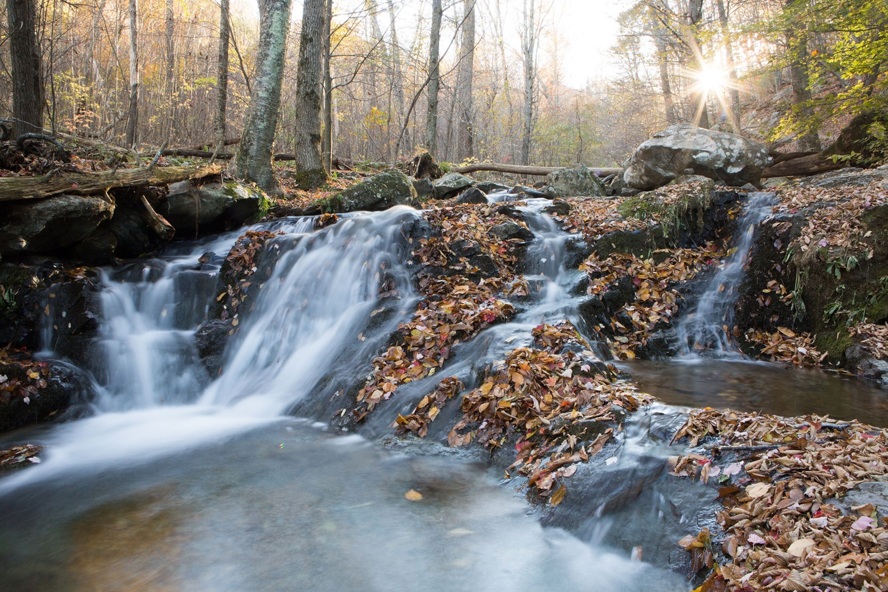
This park hugs the tops of the Blue Ridge Mountains, offering panoramic views and ample wildlife sightings.
ByNational Geographic Staff
September 03, 2019
10 min readFast facts
Location: Virginia
Established: December 26, 1935
Size: 197,411 acres
Annual visitors: 1.4 million
Visitor centers: Dickey Ridge, Byrd/Big Meadows, Loft Mountain
Entrance fee: $25 per vehicle; $10 per person
Here’s why to go
Stretching more than a hundred miles along the Blue Ridge Mountains of western Virginia, Shenandoah National Park offers a patchwork quilt of wilderness and pastoral landscapes underpinned by stories from more than 300 years of history. Located between the Shenandoah Valley in the west and the Piedmont region in the east, the park is an expanse of wooden hollows and breezy summits, waterfalls and mountain streams, more than 500 miles of hiking trails, and nearly 80,000 acres of designated wilderness—all just 75 miles from Washington, D.C.
Inspired by Yellowstone and other parks in the West, a national reserve in the Blue Ridge Mountains was first proposed in 1901. When the campaign stalled, Virginians took it upon themselves to make the park a reality. Using eminent domain, the commonwealth acquired property from some 5,000 landholders and donated the parcels to the federal government. The park was established the day after Christmas 1935.
One of the park’s most famous features, Skyline Drive (constructed in the 1930s by the Civilian Conservation Corps), offers drivers 105 miles of scenic overlooks, trailheads, picnic areas, and campgrounds between Front Royal in the north and Rockfish Gap in the south. Another way to traverse the length of Shenandoah is by hiking the hundred or so miles of the Appalachian Trail that run across the park.
In addition to Front Royal and Rockfish Gap, the park is accessible from Luray and Sperryville by way of the Thornton Gap Entrance Station, as well as from Elkton and Stanardsville via Swift Run Gap Entrance Station.
See three main districts
North District
Although it’s the closest part of the park to major metropolitan areas, the North District offers some of the more secluded terrain, a quiet part of Shenandoah that many people zip through on their way to the park’s more celebrated attractions farther south. And that’s quite all right for those who prefer their parks with fewer folks along the trails.
Dickey Ridge Visitor Center near Front Royal presents a great introduction to the park with exhibits on Shenandoah’s human and natural history and plenty in the way of information and maps. From the visitor center parking lot, you can pick up two short walking routes—the Fox Hollow Loop and Snead Farm Road—that meander through the remains of bygone farms, including an old barn and grave sites.
Overall Run Falls—at 93 feet, the tallest cascade in the park—is reached via trails from Hogback Overlook or Matthews Arm. It can be tough going: The main route (a 5.1-mile round trip) features an elevation change of 1,291 feet. Much easier is the 1.7-mile Traces Trail, which loops through the woods around the Matthews Arm Campground. The Appalachian Trail leaps across Skyline Drive near Beahms Gap, a great opportunity for those who want to hike a short portion of the trail but not the entire 2,200 miles from Maine to Georgia.
Central District
Shenandoah’s middle section is the park’s highest and most popular area, with more vehicles in the turnouts and more hikers along the trails, especially during the busy summer months when the wooded highlands offer refuge from Virginia’s notorious heat and humidity.
It’s also where Shenandoah tourism was born in the 1800s, long before the park became a reality. Skyland was originally envisioned as a mountaintop real estate development, but when that was slow to get off the ground, flamboyant owner George Freeman Pollock transformed the lofty plot into a summer vacation oasis. Many of the old buildings remain, including the restored Massanutten Lodge (built in 1911), several of its rooms decorated with early 20th-century furnishings and others dedicated to Addie Nairn Pollock and the women who frequented Skyland in the early days.
Skyland offers a convenient parking place and jumping-off spot for a number of nearby trails, including the easy, 1.3-mile Limberlost Trail through a forest that Addie Nairn saved from logging by purchasing the old-growth hemlock trees for $10 each. The hemlocks long ago succumbed to insects and were replaced by the magnificent laurels that shade the path today.
Among other routes in the area are the short but steep ascent to Stony Man peak (1.6 miles), the Whiteoak Canyon Trail (2-7.3 miles) to a series of six waterfalls, and the Skyland Stable Trail for horseback riders. Hikers can also reach Old Rag Mountain from Skyland. The shorter and more popular routes to the celebrated peak—from Berry Hollow and Route 600—are found along the eastern edge of the park.
Hawksbill Summit—the park’s highest point at 4,051 feet—is reached from trails that start at two parking spots along Skyline Drive about halfway between Skyland and Big Meadows. Despite the elevation gain, the trails are not as difficult as one might expect.
Learn more about park history at the Byrd Visitor Center, which lies about halfway along Skyline Drive (milepost 51) in the Big Meadows area. The park’s largest open space is a great place to spot wildlife in the early morning or late afternoon, especially the black bear and whitetail deer that feast on the meadow berries and other vegetation. A 1.4-mile trail drops down to 70-foot Dark Hollow Falls. Big Meadows also boasts a lodge, campground, and amphitheater for ranger talks and other programs.
Rapidan Camp is downhill from Big Meadows. Built in 1929, the rural retreat served as a wilderness White House during the presidency of Herbert Hoover. Brown House, the presidential cabin, has been historically refurnished. The Prime Minister’s Cabin offers exhibits on Hoover’s life and times. Mill Prong Trail is the easiest way to hike to Rapidan (4.1 miles roundtrip). From spring to fall, the Park Service offers 2.5-hour guided van tours from Byrd Visitor Center.
Six miles south of Big Meadows, Lewis Mountain Campground was the scene of an ongoing segregation struggle that pitted the National Park Service against local business and political interests. Developed by a private concession, it opened in 1939 as the park’s only picnic ground and campsite for “Colored People” and remained that way until 1950 when Shenandoah was fully integrated in line with Park Service policy.
South District
Seclusion returns in the park’s bottom end, like its northern counterpart much less crowded than the popular middle zone. Visitor services cluster at Loft Mountain with its campground, camp store, and amphitheater for interpretive programs. The nearby Frazier Discovery Trail (1.2-mile loop) offers a short scramble to an awesome viewpoint over the park. Another short hike is the 1-mile Blackrock Summit Trail, which climbs through a boulder- and rock-strewn talus slope on its way to another lofty vista.
Farther south, Riprap–Wildcat Ridge Trail offers a strenuous 9.8-mile hike across rugged terrain that includes rock formations, stream crossings, waterfalls, and swimming holes, as well as a portion of the Appalachian Trail.
The park finally peters out at Rockfish Gap, a large gap in the Blue Ridge Mountains between the Shenandoah Valley and eastern Virginia. Following trails blazed by Native Americans, European settlers were passing through the gap as early as the 1740s. A roadside tavern in the pass provided a meeting place in 1818 where Thomas Jefferson, James Madison, James Monroe, and other interested parties developed a plan for creating the University of Virginia.
Learn the park’s surprising story
Unlike most national parks, Shenandoah is a place where settlers lived for more than a century. To create the park, Virginia state officials acquired 1,088 privately owned tracts and donated the land to the nation.
Never before had a large, populated expanse of private land been converted into a national park. And never before had planners made a park of land so used by humans. Before the park opened and during its early days, some 465 families moved or were moved from their cabins and resettled outside the proposed park boundaries. A few mountaineers, though, lived out their lives in the park and were buried in the secluded graveyards of Shenandoah’s vanished settlements.
Much of Shenandoah consisted of farmland and second- or third-growth forests logged since the early 1700s. Today, the marks of lumbering, grazing, and farming have mostly disappeared, as forests have slowly come back.
Shenandoah National Park was built by members of the Civilian Conservation Corps (CCC), a government jobs program created during the Great Depression of the 1930s. Workers constructed the rock walls, overlooks, picnic grounds, campgrounds, trails, and the Skyline Drive. They also planted the mountain laurel that lines the road, and built more than 340 structures in the park, many now listed in the National Register of Historic Places.
This article was previously published on November 5, 2009 and last updated on September 2, 2019. It was excerpted from the National Geographic books 100 Parks, 5000 Ideas and National Geographic Guide to the National Parks of the United States, Seventh Edition, 2012 as well as articles featured in “Cutting Loose” in National Geographic Traveler.


You May Also Like


Go Further
Animals
- What La Palma's 'lava tubes' tell us about life on other planetsWhat La Palma's 'lava tubes' tell us about life on other planets
- This fungus turns cicadas into zombies who procreate—then dieThis fungus turns cicadas into zombies who procreate—then die
- How can we protect grizzlies from their biggest threat—trains?How can we protect grizzlies from their biggest threat—trains?
- This ‘saber-toothed’ salmon wasn’t quite what we thoughtThis ‘saber-toothed’ salmon wasn’t quite what we thought
- Why this rhino-zebra friendship makes perfect senseWhy this rhino-zebra friendship makes perfect sense
Environment
- What La Palma's 'lava tubes' tell us about life on other planetsWhat La Palma's 'lava tubes' tell us about life on other planets
- How fungi form ‘fairy rings’ and inspire superstitionsHow fungi form ‘fairy rings’ and inspire superstitions
- Your favorite foods may not taste the same in the future. Here's why.Your favorite foods may not taste the same in the future. Here's why.
- Are the Great Lakes the key to solving America’s emissions conundrum?Are the Great Lakes the key to solving America’s emissions conundrum?
- The world’s historic sites face climate change. Can Petra lead the way?The world’s historic sites face climate change. Can Petra lead the way?
History & Culture
- Hawaii's Lei Day is about so much more than flowersHawaii's Lei Day is about so much more than flowers
- When treasure hunters find artifacts, who gets to keep them?When treasure hunters find artifacts, who gets to keep them?
- Meet the original members of the tortured poets departmentMeet the original members of the tortured poets department
- When America's first ladies brought séances to the White HouseWhen America's first ladies brought séances to the White House
Science
- Should you be concerned about bird flu in your milk?Should you be concerned about bird flu in your milk?
- Here's how astronomers found one of the rarest phenomenons in spaceHere's how astronomers found one of the rarest phenomenons in space
Travel
- Are Italy's 'problem bears' a danger to travellers?Are Italy's 'problem bears' a danger to travellers?
- How to navigate Nantes’ arts and culture scene
- Paid Content
How to navigate Nantes’ arts and culture scene - This striking city is home to some of Spain's most stylish hotelsThis striking city is home to some of Spain's most stylish hotels
- Photo story: a water-borne adventure into fragile AntarcticaPhoto story: a water-borne adventure into fragile Antarctica
